Our Services
EXCO Imagery provides professional aerial imaging, mapping, and data solutions designed to support construction, infrastructure, agriculture, and land development projects.
From progress documentation and inspections to advanced 3D modeling and multispectral analysis, our services deliver accurate insight that helps clients plan confidently, monitor effectively, and make informed decisions.
If you have a unique project need, we’re happy to discuss custom aerial solutions tailored to your goals.
-

Infrastructure & Asset Inspections
Inspect critical infrastructure and hard-to-reach assets with detailed aerial imagery. Identify issues early, reduce downtime, and support maintenance decisions with accurate visual documentation.
-
Construction Progress Documentation
Maintain clear visibility throughout every phase of construction. Regular aerial updates provide stakeholders with reliable progress records, improved communication, and better project oversight.
-

Insurance Property Assessments
Support underwriting and claims evaluations with comprehensive aerial property documentation. Capture roof conditions, storm impacts, and risk factors quickly and safely.
-
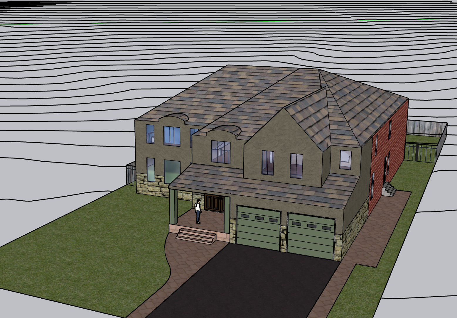
3D Modeling & Site Visualization
Convert aerial data into precise 3D models for planning, design, and development. Ideal for engineering, architecture, and site teams requiring accurate spatial context.
-

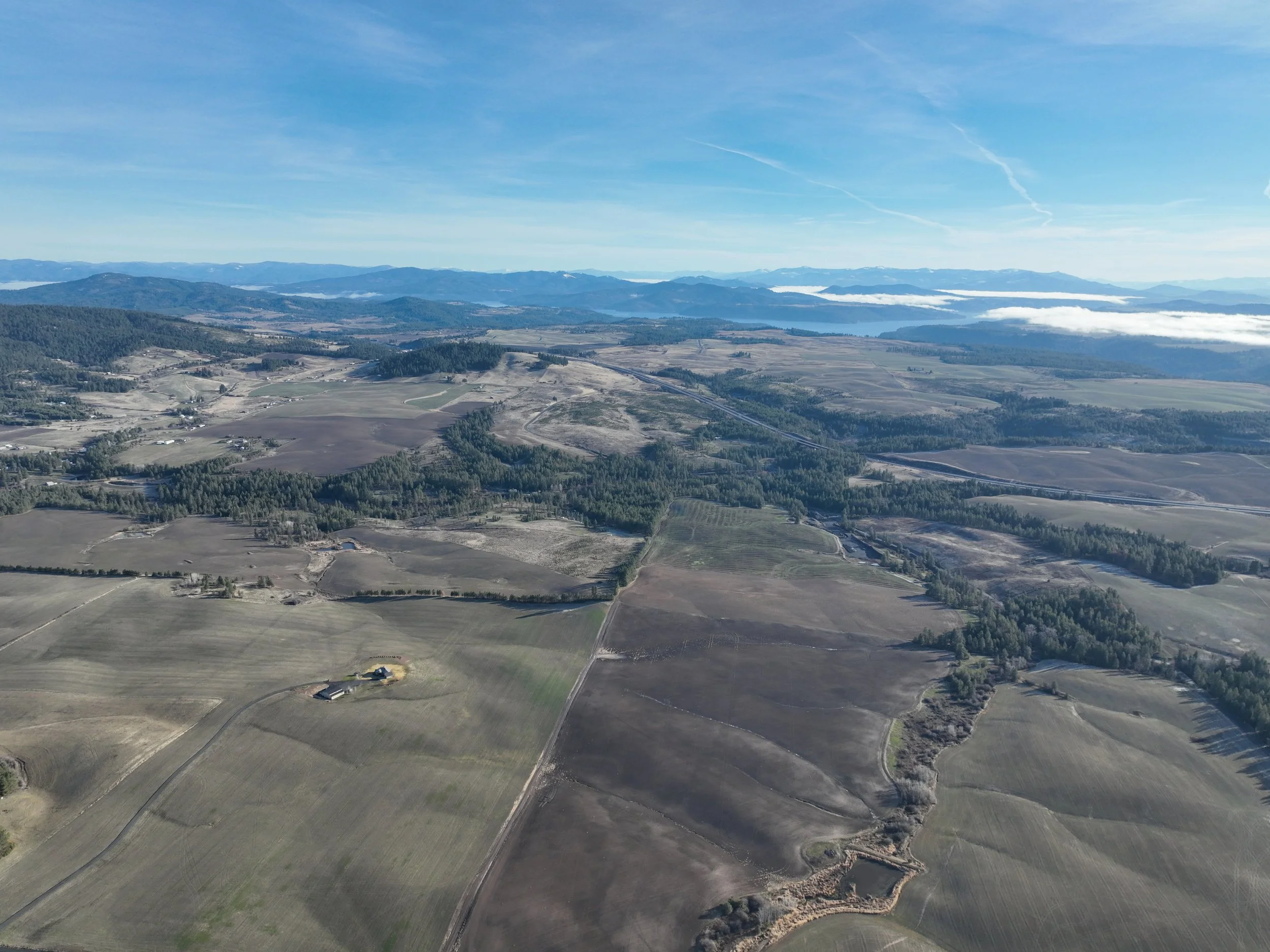
Site Layout & Development Planning
Plan homesites, land use, and development projects with a clear overhead perspective. Aerial site imagery helps optimize placement, access, and overall property layout.
-
Expansion & Redevelopment Planning
Assess existing structures and surrounding space when planning new construction or expansions. Our aerial visuals support informed decisions and efficient project integration.
-

Agricultural Health & Prescription Mapping
Improve crop performance with advanced multispectral mapping. Identify stress zones early and guide targeted resource application to increase efficiency and yield.
-

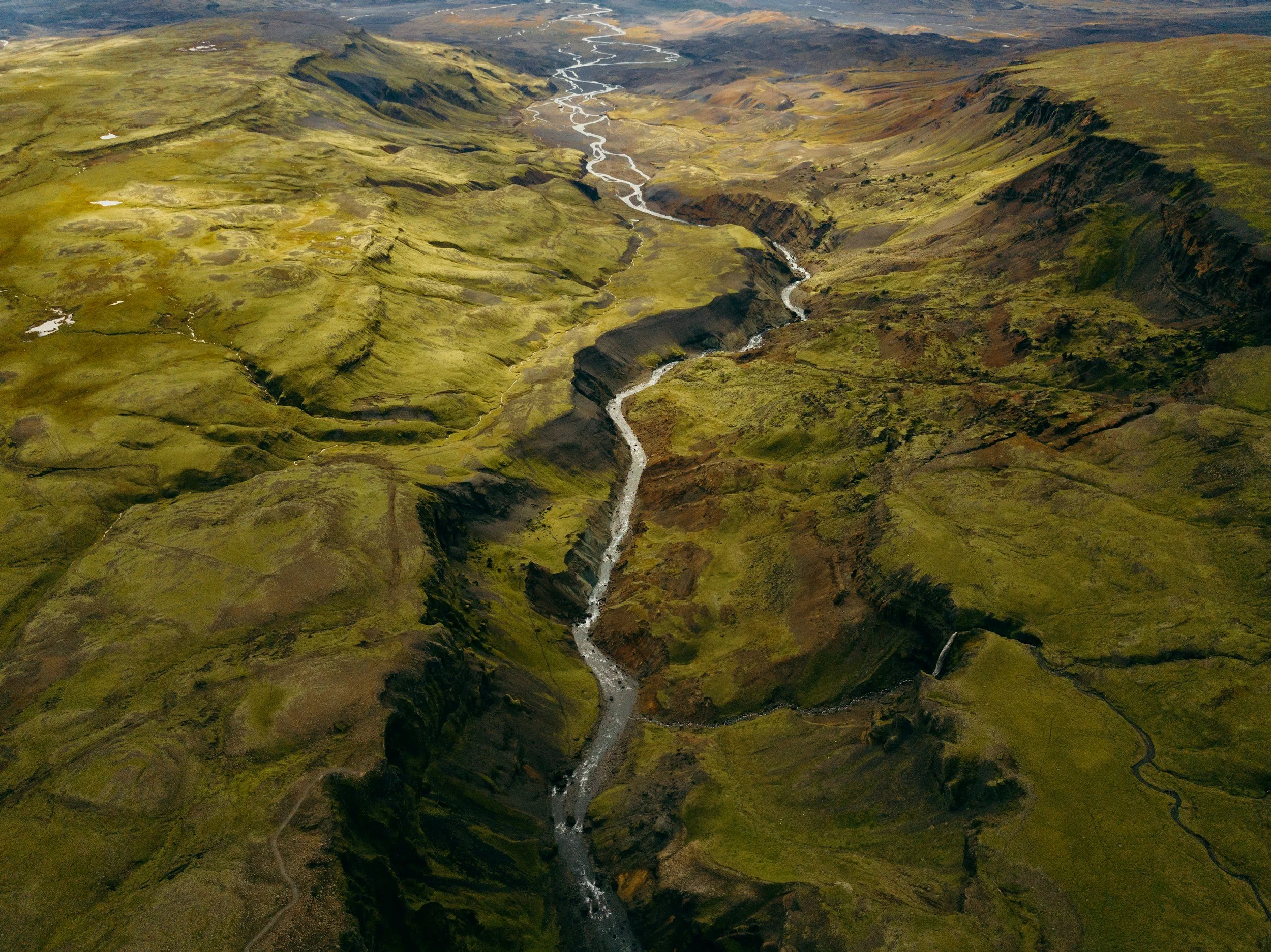
Environmental & Land Monitoring
Monitor vegetation, erosion, and land conditions with detailed aerial analysis. Support conservation goals, compliance requirements, and long-term land management strategies.
-

Emergency Response Mapping
Provide rapid aerial mapping and situational assessment following disasters or emergency events. Quickly capture critical information to support response and recovery planning.
-

Aerial Documentation Archives
Create a lasting visual record of properties, projects, or meaningful locations over time. High-quality aerial documentation preserves progress, change, and important milestones.
-

Event Operations Monitoring
Support large events with aerial visibility for layout planning, traffic flow, and operational coordination. Useful for organized venues requiring broader site awareness.